 |
| White Sands National Monument |
 |
| Pecan groves |
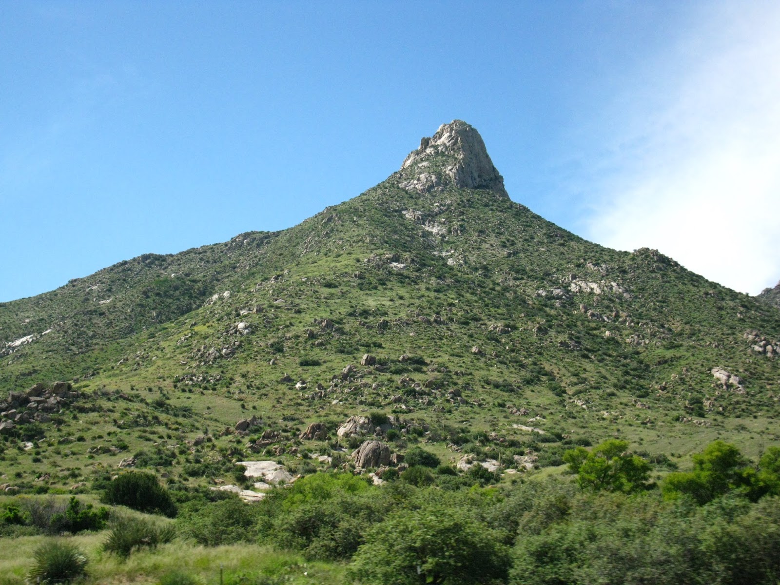
A short drive up I-10 led to Las Cruces, where we jogged east on U.S. 70, which crosses San Augustin Pass, a break between the Organs and the San Andres Mountains. At the pass we stopped to observe the craggy mountain details. Mountains completely hemmed the land below.
 |
| Dead yucca pods |
 |
| Looking west at the Organ Mountains |
The Tularosa Basin has few occupants – Alamogordo and its 30,000 people, endless rows of electric wires, White Sands Missile Range and White Sands National Monument. The monument often closes during missile tests the range, but none loomed this Sunday.
The broad bleached patch is visible from orbit. It’s just as striking on flat ground. We noticed the instant sand broke into the desert terrain, the yucca and creosote spaced out further. With no outlet for water, ephemeral lakes formed in the basin, including the national monument’s Lake Lucero, which sat dry on this Sunday.
Outside the monument we ran into our first border checkpoint – it was less intensive than in 2014, when the agents asked a battery of questions, even trying to get me to slip up by asking if we were from Nova Scotia because we both wore shirts from an Atlantic provinces. This time the agent only asked our nationality and the number of people in the car.
 |
| More dunes |
A metal boardwalk into the dune fields explains their formation and how they differ from beachfront sand dunes. Unlike quartz, the primary component in most sands, the White Sands gypsum was not hot. Despite moving sands and arid conditions, water hides close to the surface, sometimes just inches below the sand.
Yucca soared from the dunes, sometimes rising where the sands moved on. Often they die when the dunes shift, their root structures exposed. Skunkbush sumac fares better, growing deep root systems that protect the plant once the dunes move on. Evolutionary adaptations make many of the animals hard to see --- bleached earless lizards and Apache pocket mice are both paler in White Sands than elsewhere in the Chihuahuan Desert.
Bird tracks dotted some of the dunes. Visiting mid-day meant avian wildlife sightings were the only guarantee. Birds rested among shaded benches at the visitor center, but the dunes were quiet.
 |
| Fool on the dune |
Dead yucca stalks still stood, topped by the husks of old seed pods. Other plants sprouted violet flowers among desert-toughened leaves. After a little walking, it became apparent how easily anyone could become lost. We only ventured three or four rows of dunes from the car.
Without easy landmarks – the yucca plants can be hard to tell apart – diversions were everywhere. Tracking our own footprints across dunes and around vegetation brought us back to the road. The persistent whiteness of everything did grow overwhelming. When we walked on level dunes, I sometimes closed my eyes for relief. When we reached Big Bend, I bought clip-ons.
Although we weren’t equipped for camping on this trip, we wondered what clear starry nights rose over the monument on clear nights. The park has 10 primitive backcountry campsites. They lie more than a mile from the monument road. At Block-Table and Tap in El Paso that night, a bartender told us about camping in White Sands during August’s Perseid meteor shower. I envisioned walking around those dunes without a flashlight, the gypsum sands so bright to negate need for any other light. Of course I could imagine myself lost in that white wilderness.

 |
| Tasty finds at the winery |
We left the highway for major groves of pecans and other crops. Southeastern New Mexico has emerged as a top pecan region due to its hot, dry climate. The wine grapes also grow pretty well. While RGW bottles some wines from its estate grapes, it does source fruit from elsewhere in New Mexico, usually Deming. This winery also has its own pecan grove. They pour a wide range of grapes, including an excellent Spanish-style blend.
After a sample of five wines, we each had a larger pour, a bag of local pecans and exquisite panoramas of the Organ range. The mountains were the enduring image of the day. While we sipped, we looked onto the mountains that hid the Tularosa Basin and its mystic, shifting dunes.
 |
| Winery view of the Organ Mountains |
No comments:
Post a Comment