
The brilliant, challenging terrain in south-central Utah does not let up, even as Capitol Reef’s west boundary slips past. The Dixie National Forest rushes in, and climbs rapidly above the rocky f The road climbs Boulder Mountain, a mesa that is part of the Aquarius Plateau, the highest plateau in Utah. The desert disappears into a pine forest, as Boulder Mountain is the most heavily timbered mesa in North American, even more than Grand Mesa in western Colorado.
 At first, Boulder Mountain reminded me of Grand Mesa, as they have similar steep roads and overlooks high above the surrounding desert.
Overlooks provided amazing views to the east and south. With peaks above 11,000 feet, the Henry Mountains loomed to the east, the La Sal Mountains still visible as silhouettes near the horizon.
The red sandstone reef of the Waterpocket Fold struck through the desert below, and a surprising number of small lakes appeared across the national forest. The much bigger East Bowens Reservoir brought a refreshing slash of deep blue to this dry country.
We got talking to a fellow traveler, a woman out on the road with her dog headed from Atlanta to Oregon. It was nice to share the overlook with a friendly traveler taking Thanksgiving week to trek through Utah’s high country.
This was merely the opening mileage of A Journey Through Time Scenic Byway, Utah Highway 12’s designation. The 122-mile scenic route starts just west of Capitol Reef in Torrey, then crosses high country all the way to Bryce Canyon National Park and its neighboring Red Canyon Recreation Area. The warm autumn helped the drive, as Bolder Mountain was mostly free of snow, which normally starts in September. The pine-covered slopes were dotted by boulders, and the air took on a chill as the altitude increased.
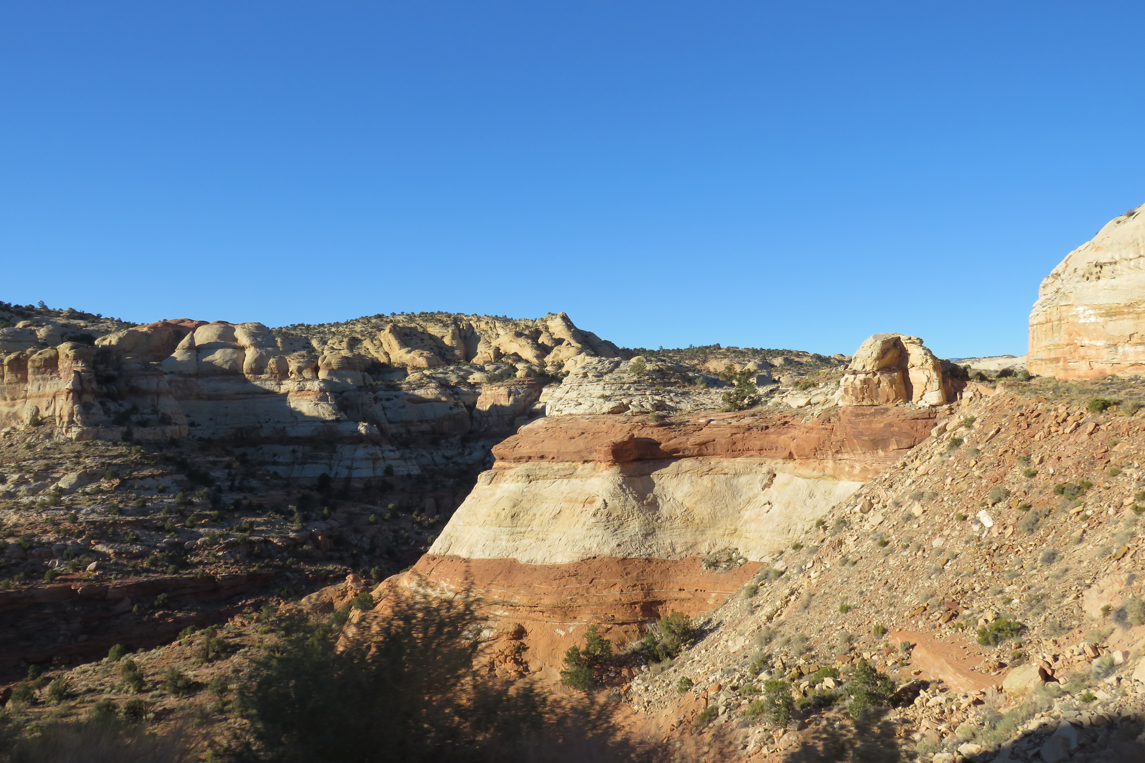
 Near Boulder, the forest enters one of the most controversial chunks of protected land in Utah and nationwide.
I understand why some wanted to shrink the Grand Staircase-Escalante National Monument – its massive, almost hard to comprehend. Covering 1.8 million acres of land where no one lives makes it someone’s idea of development for natural resources. Legal issues remain, but few would deny the stirring nature of Grand Staircase-Escalante. The problem is few have seen this country in any great detail. We had only a few hours in crossing.
Near Boulder, the forest enters one of the most controversial chunks of protected land in Utah and nationwide.
I understand why some wanted to shrink the Grand Staircase-Escalante National Monument – its massive, almost hard to comprehend. Covering 1.8 million acres of land where no one lives makes it someone’s idea of development for natural resources. Legal issues remain, but few would deny the stirring nature of Grand Staircase-Escalante. The problem is few have seen this country in any great detail. We had only a few hours in crossing.
I can hold back - the Grand Staircase is stunning in its beauty and solitude. Up close, it’s a land of changing rock layers, canyons , mountains and riverine corridors that teem with wildlife. The road skirts close to Calf Creek, a stream with two major waterfalls and one that brings fauna to the Grand Staircase that would not otherwise survive. Even in November, birdsong emanates from the creek and its shaded environs.
This was the last land mapped in the Lower 48. Route 12 has only been paved all the way to Panguitch since the 1980s, and finishing the route required another round of engineering prowess to plot a road through the canyons and over the hogbacks and mesas. The pine-covered mesa of Bolder Mountain shifted back to rocky desert with pinon and cedars everywhere, but always growing larger in places closer to water.


Not everywhere does the road curve gently. There’s no mistaking the Hogback region. The elevation and drop-offs rise and move closer to the road, all without any guardrails. Driving in the middle of the road is acceptable if no one is coming, because it runs a little too narrow for comfort before descending back into one of GSENM’s many canyons. At Escalante the twists ease up, even as the geologic wonder continues, running straight into Bryce Canyon.
Large as the monument is, it does not encompass the entire Grand Staircase, which runs down to the Grand Canyon, illustrated in a series of cliffs and rock formations exposed across multiple geographies and formations (Pink Cliffs in Bryce, as well as Grey, White, Vermillion as seen in Vermillion Cliffs National Monument, and Chocolate).
Even from the air, it’s difficult to take in the entire region. On its south side the monument stretches to Kanab, effectively circling Bryce Canyon and almost reaching Zion. Willis Creek runs out of Bryce Canyon, later forming a slot canyon with grooved sides. The land seemed to possess almost infinite choices for recreation, geology wonders and wildlife. When the drive ended and other national parks came and went, it was as hard to shake Grand Staircase-Escalante as it was to leave its enormous borders.
 | |
| Henry Mountains with Waterpocket Fold in foreground |
 |
| Mess and canyons on the west side of GSENM |
No comments:
Post a Comment