 |
| Sunset behind the Teton Range |
I followed the directions to the letter. It was not a hard route - in this part of the country, the limited number of paved roads simplified the choices.
But I had to question my location. In the western horizon in Grand Teton National Park, the Teton Range was conspicuously absent. The wildlife smoke that hazed the upper portions of the neighboring Wind River Range strengthened, blotting out Jackson Hole’s signature range entirely.
Would this smoke last the day, or engulf the whole week? I doubted it, but the first glimpses were a little shocking.
Jess, who invited me up, worked at the Moran entry station, where she worked since April. I passed through her line, meeting her in-person for the first time as she handed me a map and park newspaper.
With hours to explore on my own, I stumbled into Oxbow Bend, an old turn in the Snake River that had silted up and became a wildlife haven. That afternoon, it was far from placid - a mob had descended. Scores of people parked on the roadside, ignoring the half-empty parking lot and illegally blocking the road. The commotion might have been driven by Grizzly 399, the park’s Rockstar, a 20-something female grizzly with four cubs. But I could not contend with the crows so soon, not even for 399.
 |
| Common trailhead sign |
The mob made a good case for driving the 20-some miles up to Yellowstone National Park. On the way, I took in views of Jackson Lake, mountains trying to break free in the evening sunlight, but not getting there beyond the occasional silhouette.
While Jackson Lake is a natural lake, it has a dam that raised water levels for agricultural uses downstream in Idaho. The raised the lake 40 feet above natural levels, and the drawdowns have exposed its natural size.
 |
| Jackson Lake shore |
On first pass, the park’s scenic nature was not shining through this day. But there was plenty to see in Yellowstone Country, so I pressed on.
Rockefeller Parkway, the short scenic road that connects the two parks, took me away from the mud flats of Jackson Lake. I scouted the hills, forest and creek floodplains for any signs of nature, not finding much. At one stop, a quartet of awkward, gobbling birds flew overhead, and I realized that Grand Teton had sandhill cranes.
 |
| Lewis Canyon, YNP |
I wandered through a series of scenic drives, hunting wildlife, finding none. Pilgrim Creek Road’s meadows and shallow woods hide all kinds of large rocks ready to fool a set of eyes hoping for bears.
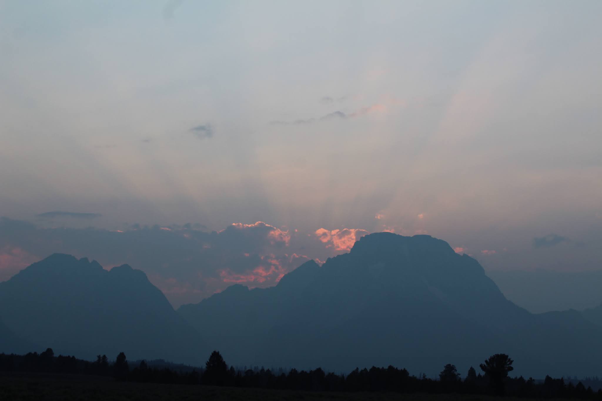
I drove deeper south as the sun began to set and the mountains finally emerged. The intensity and angle of the day’s end light through the Teton Range into blue shadows with red sunbeams branching through the clouds.
I passed Signal Mountain and staring straight ahead, the mountains finally appeared, with enough detail that I could even see the glaciers high on the three Teton peaks.
 |
| Mount Moran |
The sunset came behind Mount Moran, and the overlook named for the mountain delivered the goods. I had the overlook to myself for a solid five minutes before 4 cars pulled and children poured out. Bear in mind that five minutes is an eternity in popular national parks.
 |
| Signal Mountain |
Twilight at Oxbow Bend was a much calmer experience. What loosely qualified as chaos turned quiet and downright contemplative, last of the sun’s rays shimmering on the water. Just two cars beside mine stayed for more than a quick picture and hope of wildlife.
I trotted down to water’s edge for a glance of anything. I spotted some sandhill cranes nesting for the evening. Jess’ shift ended and I texted to let her know where I was. So we met at Oxbow Bend. While we were talking, the search for wildlife went on.
The beams illuminated something big crossing the road about 200 feet away. I knew immediately what I saw. I pointed and yelled “Black bear!” The bear lacked the signature grizzly “hump” behind the head and was not even large for a black bear. But we saw it.
The ladies looking for wildlife at the bend were loud in their disappointment, but I didn’t see why. Had I not looked when I did, I would have missed it too.
Most bear encounters – the good kind, from a distance – last a few seconds at best. That’s why we cherish them. The beer left the headlines and headed up a short hill, path unknown. Emma Mathilda Lake was down a short trail. Who knows where it roamed? But a bear, in a place where so many people gathered earlier, it sealed the sunset and redeemed any grumbling about the earlier smoke. Smoke does pass, after all, and the most colorful sunsets require some aid some clous and haze.
 |
| Last of sunset at Oxbow Bend |
No comments:
Post a Comment