 |
| Black Pool |
 |
| Black Pool with runoff |
 |
| Fishing Cone |
My first stop in Yellowstone on this trip offered only a glance at the natural wonders that lie along the Lewis River.
As the short river leads deeper into the park from the south entrance, the beauty continually unfolds.
Lewis Canyon starts with a few overlooks with trees blocking wider views, then becomes the eastern boundary of the park road, its slopes almost completely vertical at times. The colors of the Grand Canyon of the Yellowstone are more striking, but Lewis Canyon enlivens the drive.
The river then comes to Lewis Lake, the only place in its course to allow boating. A few boats bobbed in the water as we passed. We didn’t a typical newcomer’s trip to Yellowstone planned, just the southern part of the Grand Loop. No Old Faithful, Grand Canyon of the Yellowstone, Mammoth Hot Springs or Lamar Valley. The environs along Yellowstone Lake easily filled a daytrip from Grand Teton
At the steaming mud pot, turning right – that might best describe the southern approach to West Thumb. The West Thumb geyser basin has the full range of thermal features that appear throughout the park, and offers them a few feet from Yellowstone Lake, with some within the lake. Lots of people like to dwell on Yellowstone sitting atop the largest supervolcano in North America, but a small army of geologists watch it for any sudden changes. I wasn't worried about that future eruption.
 |
| A smaller Grand Prismatic Spring |
 |
| Abyss Pool |
 |
| Lakeshore Geyser |
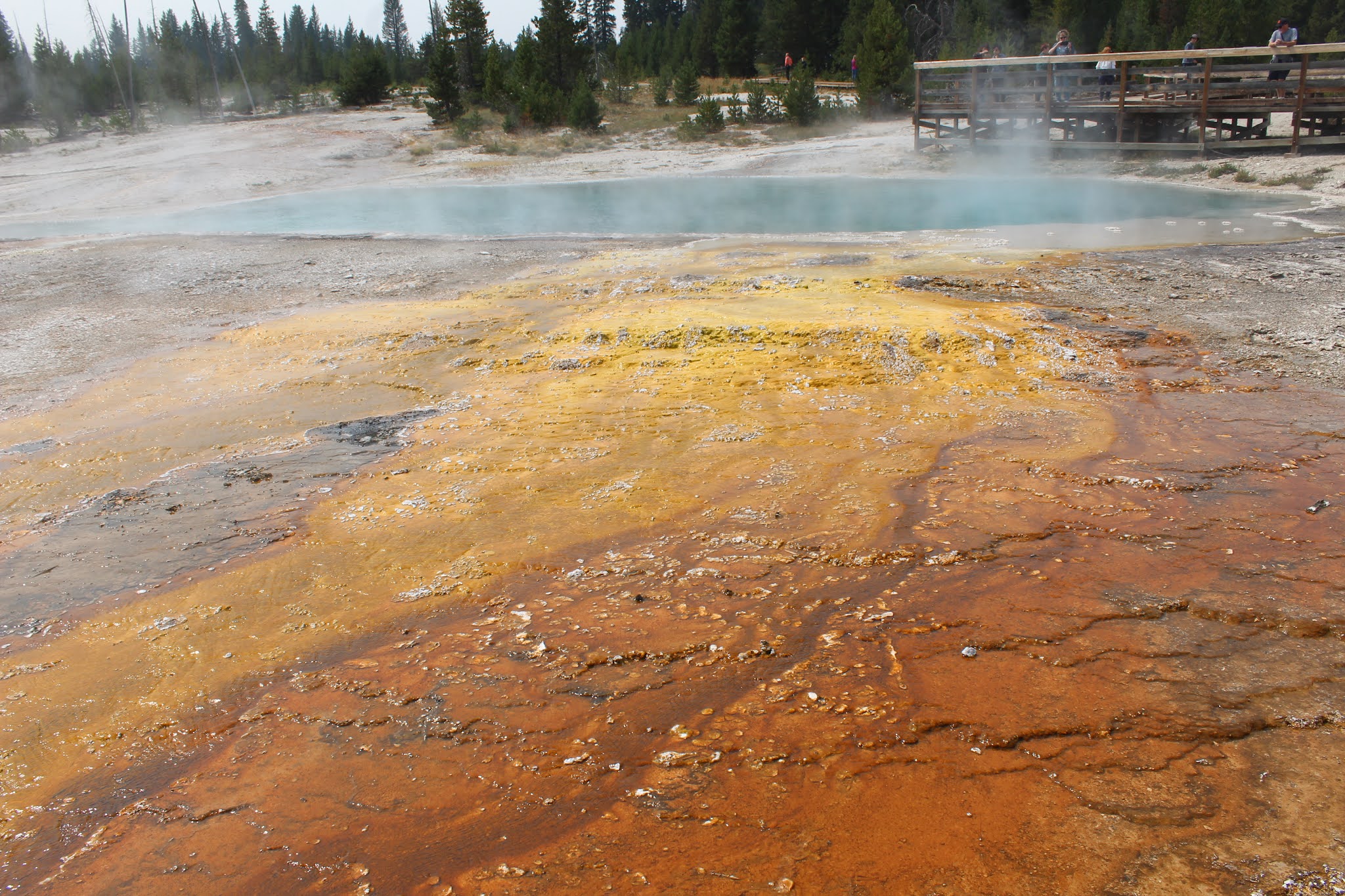
West Thumb’s features include the Abyss Pool. the deepest thermal pool in Yellowstone, with waters can run 172 degrees. Like all thermal features, it’s beauty is best observed at a distance. The much-bluer, broader Black Pool sends a stream of water down to the lake, staining the thin soils red.
A few small geysers churned up heated water along the lake edge, with a few forming tiny islands in the lake’s shallow waters. Fishing Cone had a little churning water in its side vent, while the two openings on the Lakeshore Geyser were spitting furiously albeit not erupting. Some underwater features are hard to see until winter, when they melt holes in ice that otherwise runs several feet deep.


Massive pine forests rim much of Yellowstone Lake on its northwestern shore. A few scenic drives allow closer exploration. Here in late August, there wasn’t much traffic along Yellowstone Lake.
The mountains along its southern shore barely broke through the wildfire haze, but their blue silhouettes still appeared.
Fishing Bridge lies on the lake’s north shore where the Yellowstone River forms and begins its journey north. We grabbed a quick lunch at Fishing Bridge, sitting on the lakeshore behind the closed visitor center.
 |
| The Yellowstone River begins |
A hike seemed in order before we headed back to Teton. From Bridge Bay, a major marina and camping spot, we took the short 3-mile roundtrip to Natural Bridge.
 |
| Nice marmot |
That’s the advice of someone who’s never stepped into bear country before. I still laugh at that advice. You don’t want to have to use bear spray but if you happen upon any grizzly mother and cubs - or a black bear and cubs, for that matter - bear spray sure beats having to frantically repent your sins.
The path was partially paved, a relic from Mission 66, the 1misguided 1950s-60s initiative the drastically improve NPS infrastructure, including paved trails. The pavement had not been replaced in decades, not would it ever be. A yellow-bellied marmot frolicked on some land about five feet higher than the trail. We got close, and the marmot didn’t mind.
 |
| Natural bridge |
 |
| Another angle |
The 50-foot natural bridge is a quiet, contemplative place, not especially far from Bridger Bay or other trails. Relatively few people ventured out here. Compared to the arches of Utah, the natural bridge is quite modest. At one time, a road was proposed to run across the top – fortunately that proposal died.
 On our way out we swung through Grant Village for a treat from the camp store - huckleberry ice cream sandwiches from Wilcoxson’s Ice Cream of Livingstone, Montana.
The two rivers joined and Yellowstone fell behind us while a crowd posed at the entrance sign. The first nation park not a place easy to leave, but a place whose smoking volcanic features and massive high-mountain lake are impossible to forget.
 |
| Lewis Falls |
 |
| Last of the Lewis River |
No comments:
Post a Comment